
- Département
- Aisne (Hauts-de-France)
- Site
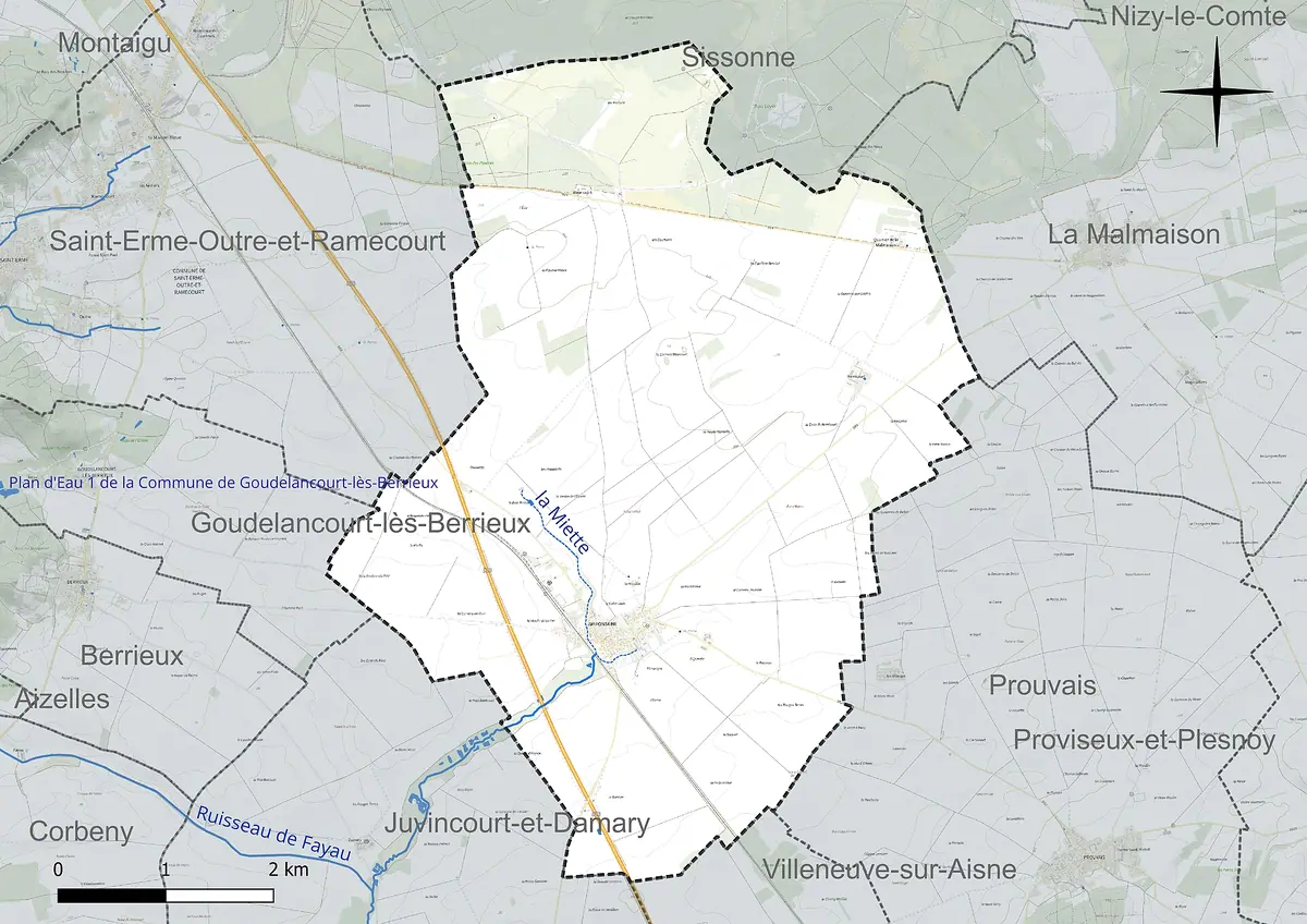
- North-western Champagne sèche, east of the Chemin des Dames
- Inhabitants
- 391 (as at 1 January 2023)
- Source
- Wikipedia, eigene Zusammenfassung
Amifontaine is a small village in the Aisne département, on the north-western edge of dry Champagne. It is not a cru village, but it sits at the source of the Miette and within the orbit of Reims.
If you only associate Champagne with vine-covered slopes and chalk cellars, Amifontaine shows you another side of the region: arable land, wide horizons and a quiet village on its north-western edge. It is neither a grand cru nor a premier cru village, and the sources available to me mention no viticulture here. Even so, the landscape is worth a look, because this is where Champagne slowly gives way to Picardy.
Location
Amifontaine belongs to the Aisne département in the Hauts-de-France region, to the arrondissement of Laon and the canton of Villeneuve-sur-Aisne. The village lies immediately east of the Chemin des Dames ridge, already in the north-western foothills of the Champagne sèche, or dry Champagne. To the north, the commune shares in the large Camp de Sissonne military training area, and the A26 motorway runs through its western side. Neighbouring communes include Sissonne, La Malmaison, Prouvais, Juvincourt-et-Damary, Corbeny and Berrieux. With 391 inhabitants (as at 1 January 2023), Amifontaine is a small commune with scattered buildings. It forms part of the Reims catchment area and of the Communauté de communes de la Champagne Picarde.
Landscape and climate
Well over 84 per cent of the commune's area is agricultural, mostly arable land at around 82 per cent. Woodland accounts for about 5 per cent. The climate is oceanic, with moderate sunshine, rainfall spread evenly through the year and cold winters. At the nearest weather station, in La Selve, eleven kilometres away, the annual mean from 1991 to 2020 was 10.8 °C, with rainfall of around 711 millimetres. For growing vines in the heart of Champagne, that is a noticeably different setting.
With 391 inhabitants (as at 1 January 2023), Amifontaine is a small commune with scattered buildings.
Name and water
The village name points to water. The Miette, formerly called the Amiette, rises at Amifontaine: a small river some 15 kilometres long. It flows south and joins the Aisne near Pontavert and Berry-au-Bac. The name probably derives from the Gaulish root Ambe, meaning stream. The form Amia Villa is already recorded in 1199, recalling a Gallo-Roman estate on this spot. The present spelling first appears as Amy fontaine in 1530.
 Boizel Champagner
Things to see
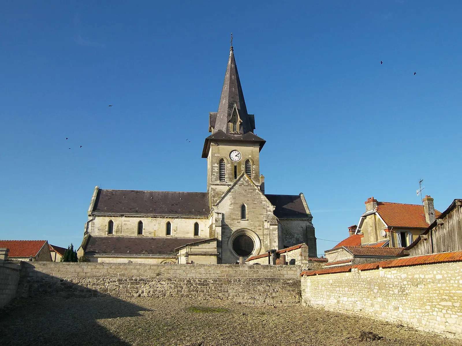
Do not expect grand monuments. Two structures shape the look of the village:
- the church of Saint-Rémi
- two water towers
Saint Remigius is also a central figure in Reims, which makes the church a small point of reference for anyone travelling in Champagne. Amifontaine works well as a stop on a drive along the Chemin des Dames or between Laon and Reims. If you want to taste champagne, the growers and houses are further south, around Reims and along the Marne.
Pictures
 0 %